
Researchers recently discovered, and mapped for the first time, that the long-misidentified Antarctic “danger zone” is actually an island.
The discovery was announced in an April press release from the Alfred Wegener Institute (AWI), a German polar research center based in Bremerhaven.
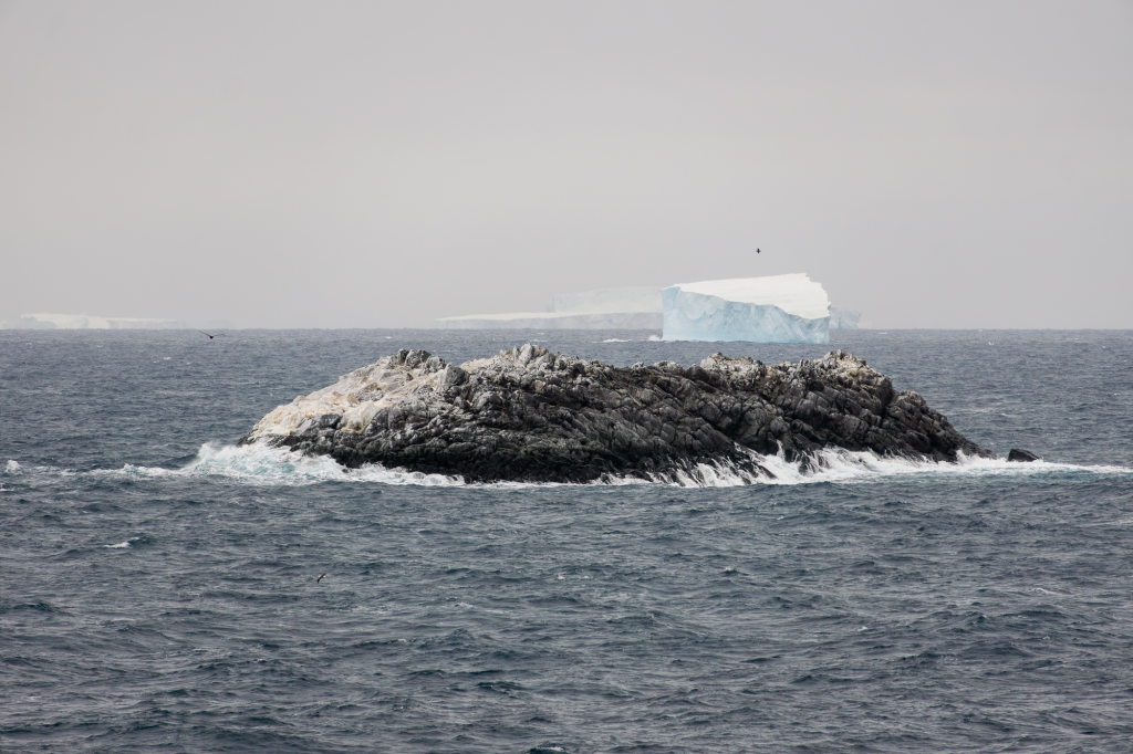
The island is located in the northwestern part of the Weddell Sea and was discovered during an expedition aboard AWI’s icebreaker Polar Stern.
Researchers were initially studying the region’s rapid decline in sea ice, but bad weather forced them to suspend their work.
They took shelter on Joinville Island to avoid the wind and waves, but later discovered a previously unidentified island there.
“The charts showed an area of unexplored danger to navigation along our route, but it was not clear what it was or where the information came from,” Simon Druther, AWI’s bathymetric data engineer, said in a statement.
After examining available coastline records, Druther looked out the window and spotted a “kind of dirty-looking ‘iceberg.'”
He recalled, “I looked closer and realized it was probably a rock.”
“Then we changed course and headed in that direction, and it became more and more obvious that there was an island in front of us.”
The researchers approached the island, circled it, and surveyed the ocean floor using sounders and drones to take images. This marked the first time this area had been surveyed and recorded.
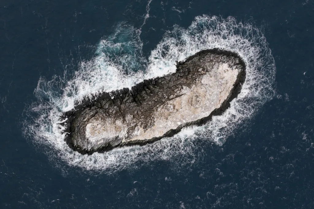
The island is approximately 426 feet long and 164 feet wide.
Officials said it “protrudes approximately 16 meters (52 feet) above the water.”
Officials are still unsure why the island was marked as a danger zone, noting that from the air it resembles the surrounding icebergs.
The reason may have to do with the number of unmapped shoals on the ocean floor, a representative of the institute said.
Officials speaking on behalf of the research team told Fox News Digital that the region appears to have “hilly areas where water depth can change rapidly over very short distances.”
“Most regions are modeled from low-resolution satellite data,” said an AWI representative.
“Therefore, many regions, especially coastal and near-shore areas, can be seen as white dots or gaps on the map. As a result, nautical charts also have patchy data coverage.”
The island has not yet been officially named, so a formal naming process will now take place and a proposal will be submitted to the Scientific Committee for Antarctic Research (SCAR) for consideration.
The era of exploration may seem over, but officials say less than a quarter of the Weddell Sea is fully charted, and there’s still much to discover.
“The discovery of an island, even in a remote part of Antarctica, is a rare and exciting event since satellite observations,” the spokesperson said.
“But only about a quarter of Antarctic waters are charted, so there’s still plenty of room to discover the topography of the ocean floor.”
#Explorers #discover #unknown #Antarctic #island #labeled #danger #zone #map